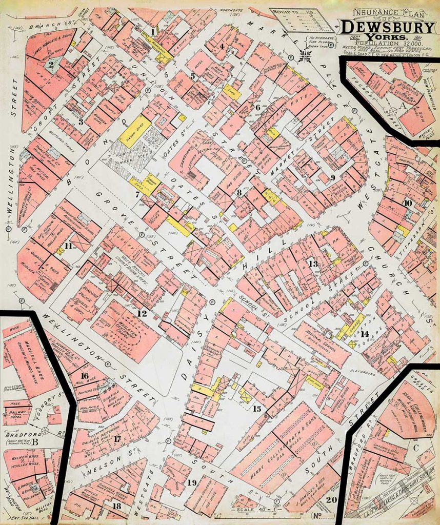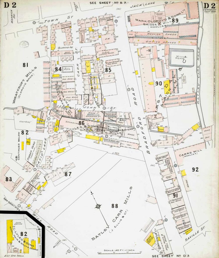
These detailed late 19th century plans of Dewsbury were produced to aid insurance companies in assessing fire risks. The building footprints, their use (commercial, residential, educational, etc.), the number of floors and the height of the building, as well as construction materials (and thus the risk of burning) and special fire hazards (chemicals, kilns, ovens) were documented in order to estimate premiums. Names of individual businesses, property lines, and addresses were also often recorded. Together these plans provide a rich historical snapshot of the commercial activity and urban landscape of the town at the time.
Select a zoomable plan by tapping a marker on the Key map below (Not dispayed on mobiles) or scroll down to choose one by plan number.
(plan will open in a new tab)